Land & Utility Surveying
SOCOTEC, formerly 40Seven's Land & Utility Surveying services provide accurate and innovative solutions for mapping, measuring and analysing land and underground utilities.
Our expert team utilises technology and proven methodologies to deliver precise data and insights, enabling informed decision-making for your projects.
As urban areas expand and infrastructure becomes more intricate, the complexity of underground utility networks increases, making accurate mapping and management challenging. This can lead to conflicts and inefficiencies during construction and maintenance. The growing demand for precise land information puts pressure on surveyors and geospatial professionals to deliver high-quality data essential for efficient and safe project planning, design, and execution. Traditional survey methods can be disruptive, necessitating advanced, non-invasive techniques like ground-penetrating radar and remote sensing to minimise disturbances.
Projects often face strict deadlines and budget constraints, making efficient planning and execution critical to avoid delays and cost overruns. Effective project management and innovative solutions are vital to meet these challenges. Safety in excavation and construction activities is paramount, given the risks posed by complex underground utilities. Ensuring worker and public safety requires meticulous planning, adherence to safety protocols, and the use of advanced technologies to detect and avoid hazards.
Get an in-depth take on our services
What is a Topographical Survey?
Before considering any construction project, it is important to have accurate information about the site’s physical features to serve as the basis for all future work.
Here you will find all you need to know about topographical surveys to deliver a successful construction project.
Discover our work in action
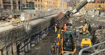
Time and Cost Savings for Newhaven Port Access Road Project
We supported BAM Nuttall Ltd with multiple services during the pre-construction and construction phases of the Newhaven Port Access Road scheme, delivering time and cost savings to the Contractor.
A number of pre-construction services have been delivered by SOCOTEC in order to identify the existing conditions of the site and areas adjacent to the site, starting with first establishing the risk of any unexploded ordnance (UXO).


Land & Utility Surveying
Our Approach

We tailor our approach to each land and utility surveying project, combining our expertise with advanced technology for accurate results.
Our process begins with a thorough consultation to understand project needs, followed by selecting the most suitable survey methods.
We then collect data using state-of-the-art equipment, ensuring precision across various environments. Our team processes and analyses this data producing clear, detailed reports that often include visual representations.
We also assist in integrating our findings with clients' existing systems and provide ongoing support. This approach ensures our clients receive actionable insights that drive informed decision-making and project success.

Take a look at our News & Media
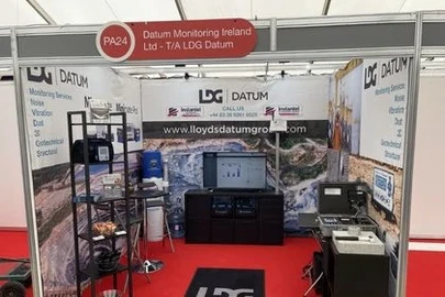
LDG Datum returns to Hillhead show for 2026 with SOCOTEC backing

SOCOTEC nominated for trio of ground engineering excellence awards

Discover the Future of Highway Surveys: Traffic Speed Video & GPR Insights

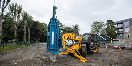
Utility Coring - Understanding the Process